
Overnight in the Four Peaks Wilderness
About a year ago a small group of us did the first “club” hike to Browns Peak in the Four Peaks Wilderness (see blog entry here —> https://oldslowhans.com/2015/02/28/four-peaks-looking-down-on-the- supes/ ).
When writing up my blog of that hike, I made this observation “wouldn’t this be a great spot to photograph the sunset and a following sunrise”. Well, such a notion obviously implies spending the night in the wilderness, because hiking out after sunset, or hiking in before sunrise isn’t an option.
So over the summer I gently hinted to my son Chris that this might be a worthy adventure for his next visit to Arizona. Frankly, I wasn’t prepared for his enthusiastic involvement.
Over the summer he assembled the “kit” we’d need for the trip, including MRE food packs, sleeping bags, backpacks, small “one man tents” called “bivvies”, and other miscellaneous items I wouldn’t have thought of. Last Sunday he arrived in Phoenix, and we promptly scheduled the hike, leaving Monday and returning Tuesday.
Our destination is a saddle just below the summit of Browns Peak. On our previous hike I had noticed numerous good campsites here.
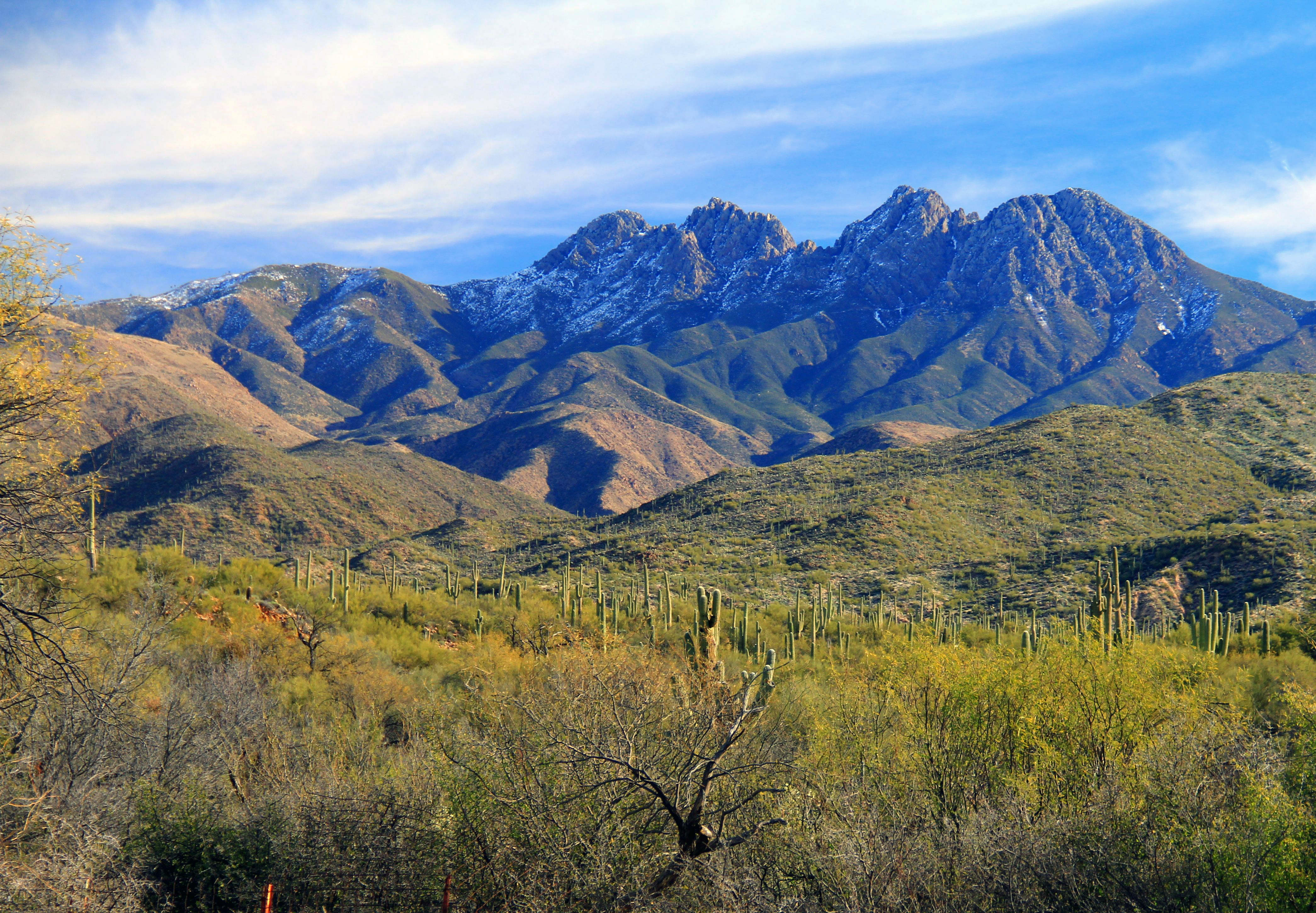
 In the photo above, Browns Peak is the leftmost of the four higher peaks. It rises to a height of 7,659 feet. The saddle where we will sleep is about 800 feet below the summit.

Our hike starts at the “Lone Pine” trailhead, about 2.5 miles from the saddle at an elevation of 5,740 feet. Last year we drove to the trailhead via FR143, a tortuous 18-mile trip sponsored by Monroe-matic shock absorbers and your local chiropractor. A nasty road indeed. Our route this time was via El Oso Road, a 10-mile gravel road in much better condition.
The elevation change on the hike will be about 1,100 feet. Last year, with just a day pack, I considered that hike “moderately difficult” because of the thin air, but not a tough climb.
But with significant packs (see Chris and Snoopy above) full of food, water, sleeping bags, ground mats, bivvies, extra clothing, and a bottle of nice wine, we agreed that we’d had our butts kicked on the hike in.
Also, last year the trail was completely dry but this time we had to traverse a stretch, about 200 yards, of slippery footing due to wet snow.

Remember the name of that road we drove to the trailhead? “El Oso”. Spanish speakers, please translate for the rest of us. “Oso” = “Bear”. The Four Peaks wilderness contains the largest concentration of black bears in Arizona, and along the trail we found a pile of fresh evidence of what “bears do in the woods”. But Smokey was not spotted. My guess is that our rough demeanor scared the “crap” out of him, and he headed for Utah.
The early part of the trail is in a Ponderosa pine forest, with views mostly to the west.

Higher in the trek the views shift eastward over Tonto Basin and Roosevelt Lake. At this elevation we rise mostly above the pine forest.

We arrived at the saddle around 3:30, and the first order was to select a camp site and set up camp. The camping area that I had anticipated using because it was exposed to sweeping views was also, unfortunately, exposed to strong winds which had come up over the area. We scouted around and found another site, protected from the wind in a “hollow” nearby. Even there it was breezy, so we cancelled plans for a campfire, not wanting to burn down the mountain.
Here you see our home for the night. The two small “bivouac” tents with sleeping bags inside kept us was comfortably warm all night, although temperatures fell WELL below freezing, and the wind persisted at around 30MPH all night.
The snowbank peaking out at left-center-edge of the photo was pressed into service as our wine cooler, and it was a tad unsettling to discover a set of cougar tracks (at least a couple days old) crossing our “refrigerator”.

With camp set up, we had about an hour before sunset. We elected to delay supper until after sundown to take full advantage of the “golden hour” photography.

The best views were westerly, where the winds had kicked up a mist of dust, giving the sunset a rich golden tone. In the scene below, the Superstitions (Flatiron) lie in upper left, with Saguaro Lake faintly visible to the right.

In the scene below a lone bird flies westward into the sunset. The prominent mountains at the horizon are about 50 miles away, the most prominent peak being South Mountain. The middle range (just beyond the bird) is the area around Usery and Pass mountain, and the closer ones are the Goldfields around Saguaro Lake.

Below is a sunset scene looking northeast towards Payson and the Mogollon Rim country.

I have about 35 shots of this sunset! The range of colors over time was just astounding, changing almost minute-to-minute!

After sunset we enjoyed our dinner in the twilight and settled in for the moonrise. (The timing of our adventure was perfect, corresponding to the date of a full moon.)
Here’s a “halloween-ish” shot through the trees. The bright moon shone all night, bright enough to cast shadows.

Here’s a view westward from our camp spot. The lights of Phoenix are about 45 miles away, and the foreground is lit by moonlight.

Below is a panoramic shot showing the entire valley. The dim cluster in right-foreground is Fountain Hills, with Scottsdale in right background, Phoenix right-center, and the “east valley” stretching out to the left of the image. The light streak at right-top is a passing aircraft (this was a 30-second exposure).

We turned in about 2100, in expectation of early 0630 reveille for the sunrise. The accommodations were surprisingly comfy, in spite of the cold and wind.
Crawling out in the morning, the temp was about 25, and the wind at least 30mph. That works out to a windchill of about 8!
Overnight the wind had shifted to the east bringing clear mountain air to the valley as opposed to the dusty desert air of last evening.
In the blue predawn light, this eastern ridgeline was too good not to shoot. The near foreground is “our” Browns Peak, and the layers of mountains marching eastward in the mist are the Sierra Ancha range (at mid-left) and the White Mountains to the eastward.

As dawn broke over the landscape, there was an ever-changing drama. Here the peaks of the Superstitions are highlighted as they are raked by the first rays of the rising sun.

After about an hour of sunrise photography we broke camp and headed back to civilization.
Closing on a personal note, I want to again thank my son Chris for being the “head outfitter” to pull of the hike of a lifetime for this old man. Without your help this hike would still be a dream; now it is a memory. Thanks, kid!
Posted in Arizona hiking
Tagged Four Peaks, hiking, Mazatzal, Mazatzal wilderness, wilderness
9 Comments
Beat(en) Feet to the “Narrows”
Hiking companion Rod calls this the “DD Death March”.
I’ve heard he exaggerates other stuff too!
Actually it is a quite a workout, but the reward of visiting LaBarge Narrows is worth the effort.
This is a 12-mile (round trip) trek from First Water trailhead, out to Garden Valley (why do they call it a “valley”, it’s a damn plateau!), then down through Second Water canyon to the Boulder Canyon trail, upstream in that canyon to the “stern” of Battleship, up over a steep saddle, the down into lower LaBarge Box just north of the Narrows. (And return)
Like the Rogers Trough hike, this one saves most of the climbing for the return leg. All-in-all start-to-finish you will gain about 1,500 feet of elevation in aggregate.

The first stretch of the hike up to the east end of Garden Valley is an easy unremarkable stroll. At this crest, however, the scene changes.
Here is the view, just as you start to descend into Second Water canyon. Left of center mid-distant is Battleship mountain, and beyond it the Geronimo Head massif. Classic Superstition mountain interior!
Second Water canyon is a fairly steep descent on gnarly footing down to the intersection with Boulder Canyon trail.
And Boulder Canyon comes by its name honestly! Because of generous rain early in January, the creek still has some flowage. Rock hopping was the order of the day, and stream crossing points are not always obvious. Examining my track (see the opening map graphic) there are a number of spots where I chose the streamside opposite between my inbound and outbound routes.


 After around a mile in this canyon the route takes a left turn over an unofficial (and sketchy) trail over a saddle at the stern end of Battleship mountain.
Nearing the top of this low saddle there are great views to the south, showing the upstream course of Boulder Creek towards Cavalry Trail, and Weavers Needle standing guard on the horizon.

Cresting the saddle, to the north is a view of the “bow” of Battleship mountain (left), and Geronimo’s Head on the opposite side of LaBarge Canyon.

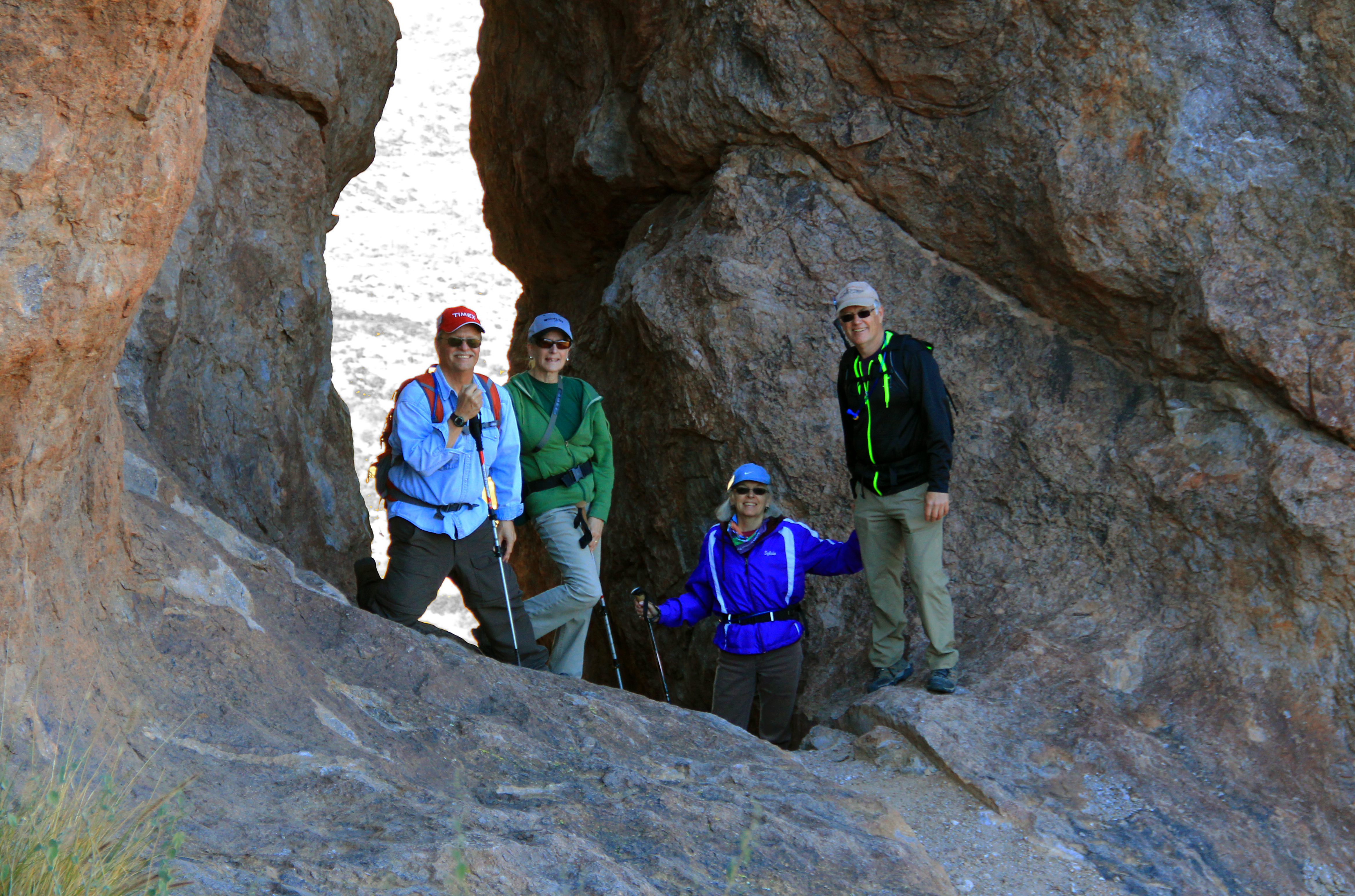
Our destination, “the narrows” lies below us in the dark basalt canyon to our right. Do you see the hikers in this scene? You need to look close!

To give you a sense of the scale, here’s that photo again with a segment “zoomed” to show several of my companions enjoying their lunch below.

The “payoff” for your work is LaBarge Narrows, a deep and craggy slot canyon carved through this dark volcanic cone. A camera doesn’t do justice to this place, but here are a few examples of scenes we saw.


The turnaround point was a chance for all to rest out battered feet, and catch a drink of water before heading back to the trailhead.


The “highlight” of the return leg is the climb up Second Water canyon on that nasty footing. I’ll admit, in deference to Rod, that there were some moments on that ascent when I hallucinated about finding an elevator to the top. It’s a relentless climb. The trail gods were forgiven, though, on passing the ruins in Garden Valley and heading back on a smooth path to the trailhead.
Another day, another canyon or two
Yesterday we we hiked a loop in the Box Canyon area, east of Florence. This is an old standard of our group, about 6 miles long. The “trailhead” is at the west end of Box Canyon (lots of parking) reached by thirteen-and-a-half miles of bumpy/dusty Price Road, jointly sponsored by Monroe-Matic Shock Absorber Company, Inc., and AC Delco Air Filters.
There are three stages of this hike.
The first stage is an easy walk through Box Canyon. The high cliff scenery and wide flat canyon bottom makes this segment popular with not only hikers, but also Jeeps and ATV’ers. I recommend it to my 4-wheeled friends who aren’t able to hike.


Exiting the other end of Box Canyon puts you in stage two, on a jeep road which circles up over a ridge to the southeast. Pause at the crest of this ridge to admire the views!
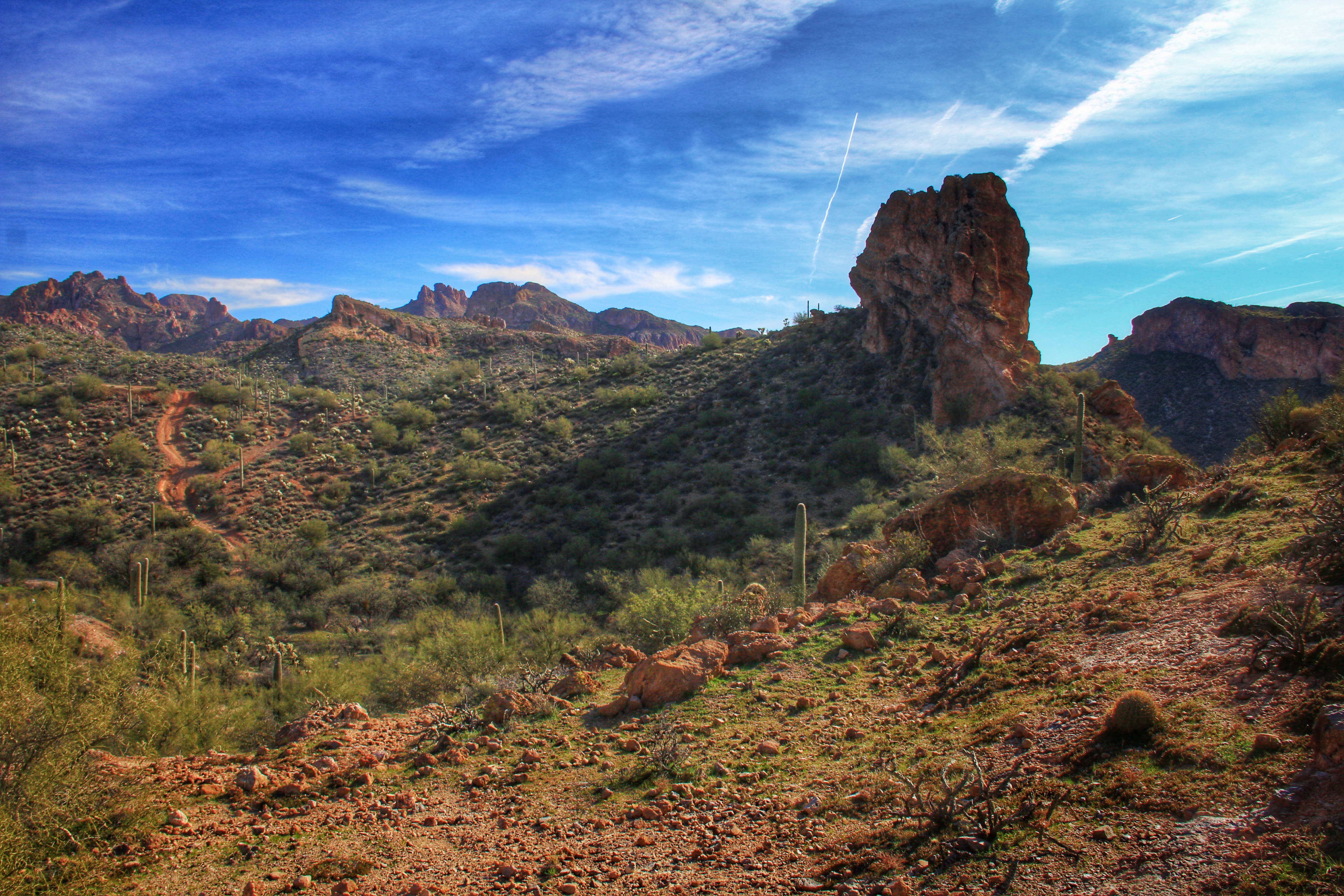
As you drop off the ridge to the valley below, leave the jeep road at the first arroyo to your right.. This is the third and prettiest stage of the trek.
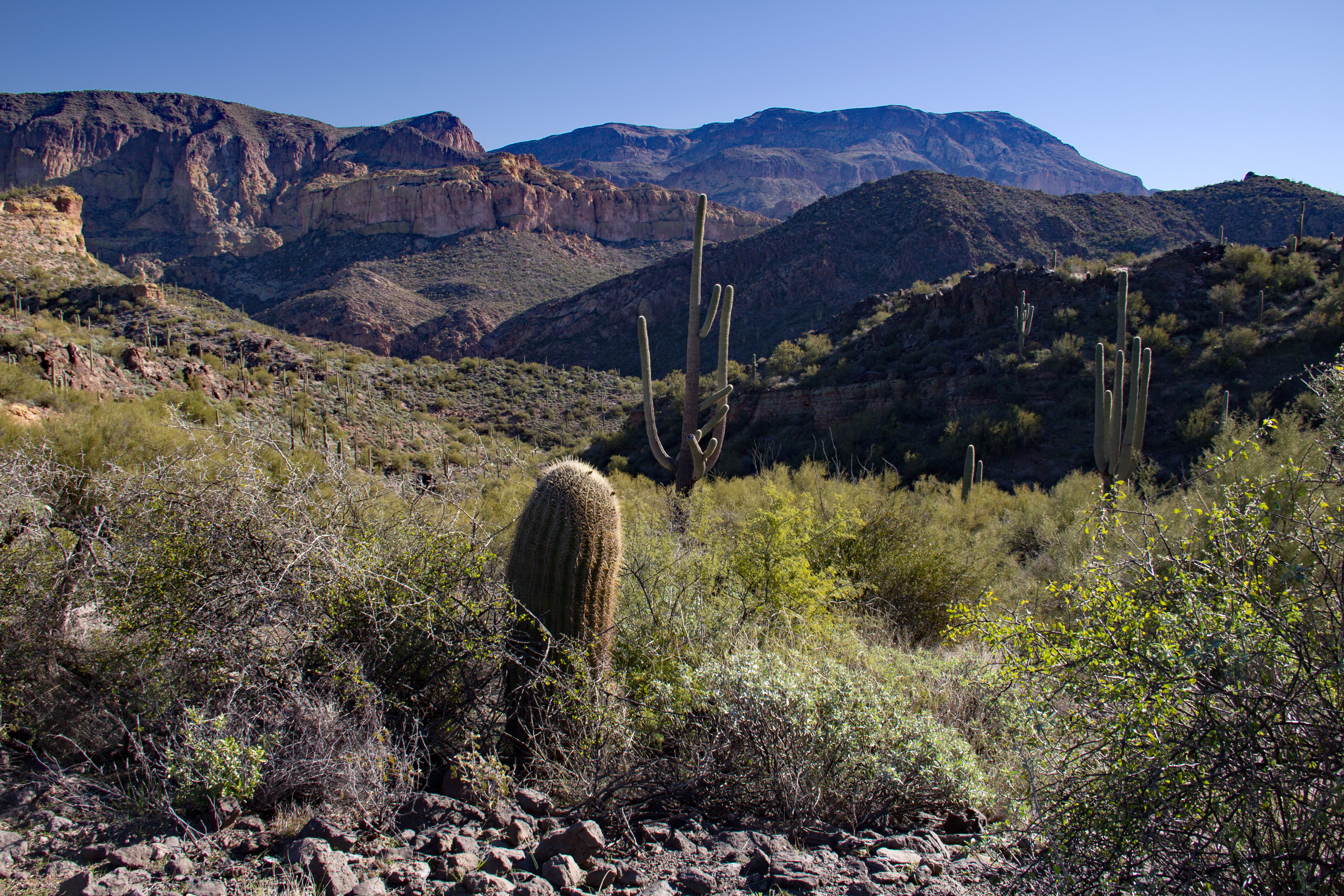
At first you’re in a broad canyon with gorgeous craggy walls and “John Wayne” scenes like this.

Soon, however, the walls close in tightly, and for about a mile-and-a-half it’s pretty much a single-lane slot between the canyon walls.

In a few spots there are dry waterfalls a few feet high which require careful maneuvering.

We were told that we might see mountain goats in the area. Does this “old goat” count?

The narrow canyon continues, eventually rejoining Box Canyon near our original starting point.


A closing note on the topic of “be careful out there”. One of our company had a footing-malfunction on a rather benign section of the trail and fell, badly dislocating a finger. He’ll be fine, but a reminder “safety first”.
Posted in Arizona hiking
6 Comments
Wet Feet in Cottonwood Narrows
The scheduled hike for this Wednesday was either a “challenger” trip up the Flatiron, or an intermediate trip to Siphon Draw. Probably would have done Siphon Draw, but frankly that one isn’t on my “top 5” list. But Monday afternoon I got an email and visit from George asking me if I wanted to try “a new one”. He planned to hike “about 10 miles over flat terrain” through a “gorgeous canyon” below Four Peaks north of the Salt River.
Sign me up!
The trek he planned was the lower 5 miles of Cottonwood Creek (10 miles round trip). This creek starts high to the east below Browns Peak, and is the major drainage of the entire western flank of Four Peaks.

To reach the creek we drove north on the BeeLine highway to Forest Road 143. After a few miles on 143, hang a right on Forest Road 401 until it terminates in a valley at an old cattle station called “Cottonwood Camp”. You can identify this parking spot by the corral, and a huge old stone water tank.

Lots of parking room here, and the camp lies right next to the creek, so makes a great trail head.
Although it’s still about 10-12 miles away, Four Peaks dominates the eastern horizon. It still has a fair amount of snow remaining from last weeks storms.
We will head south out of here, downstream toward the Salt River.
 There is a lot of ATV/OHV activity in this area, so the early part of the hike is on a 4-wheeler trail which criss-crosses the creek several times in the first couple of miles.

There was a fairly generous flow of water, but in this stretch the streambed is flat and broad, so stream crossings were “feet dry” for the most part, jumping from rock to sandbar to rock, etc.

The first couple of miles were in a wide shallow valley, good cow country which explains the abandoned cattle camp where we parked.
Gradually the valley narrowed however, and we could see the first of the canyon walls ahead.

Just before this narrowing (see above) there are the ruins of a stone structure, probably an old line shack for the ranching operations in the area.


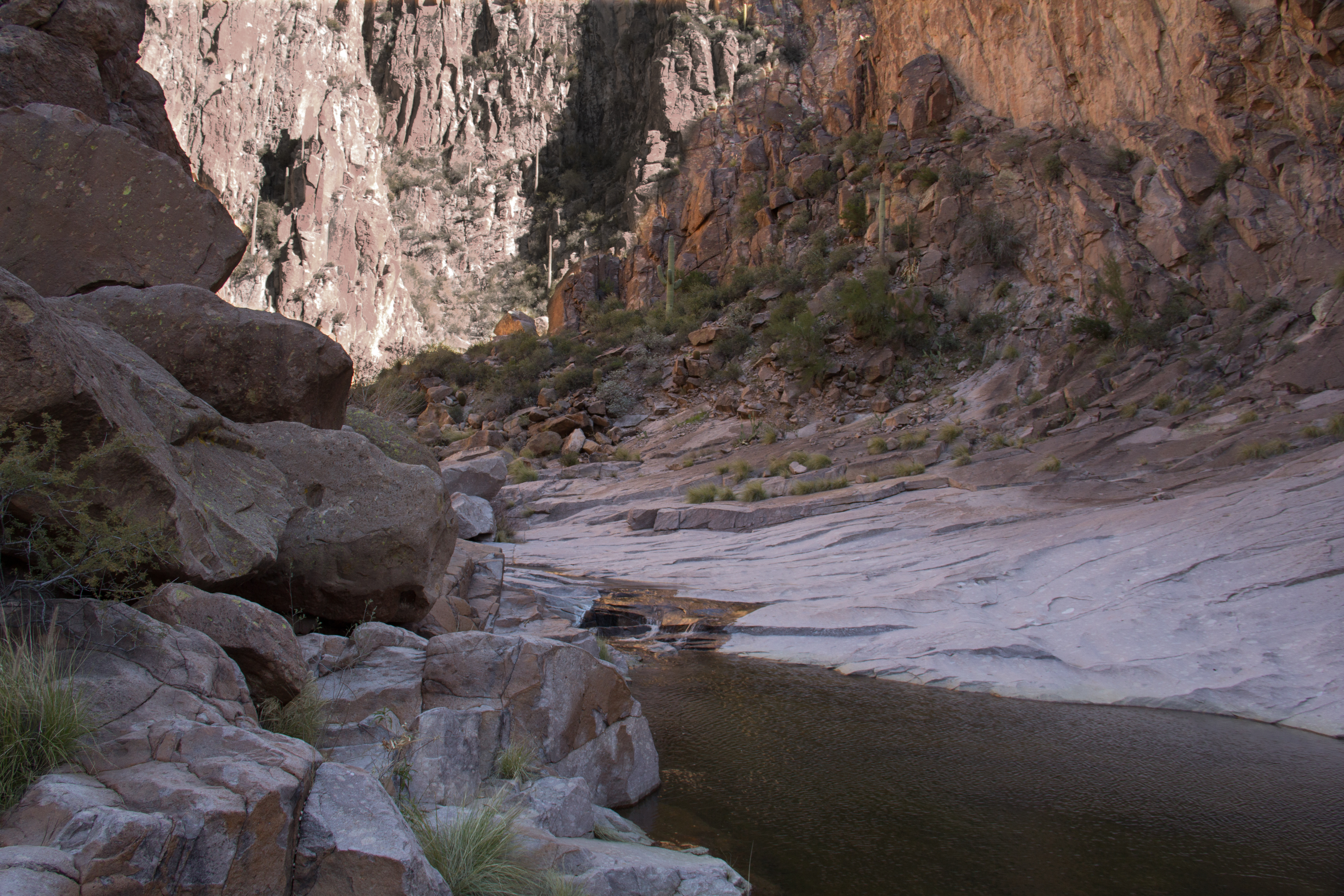
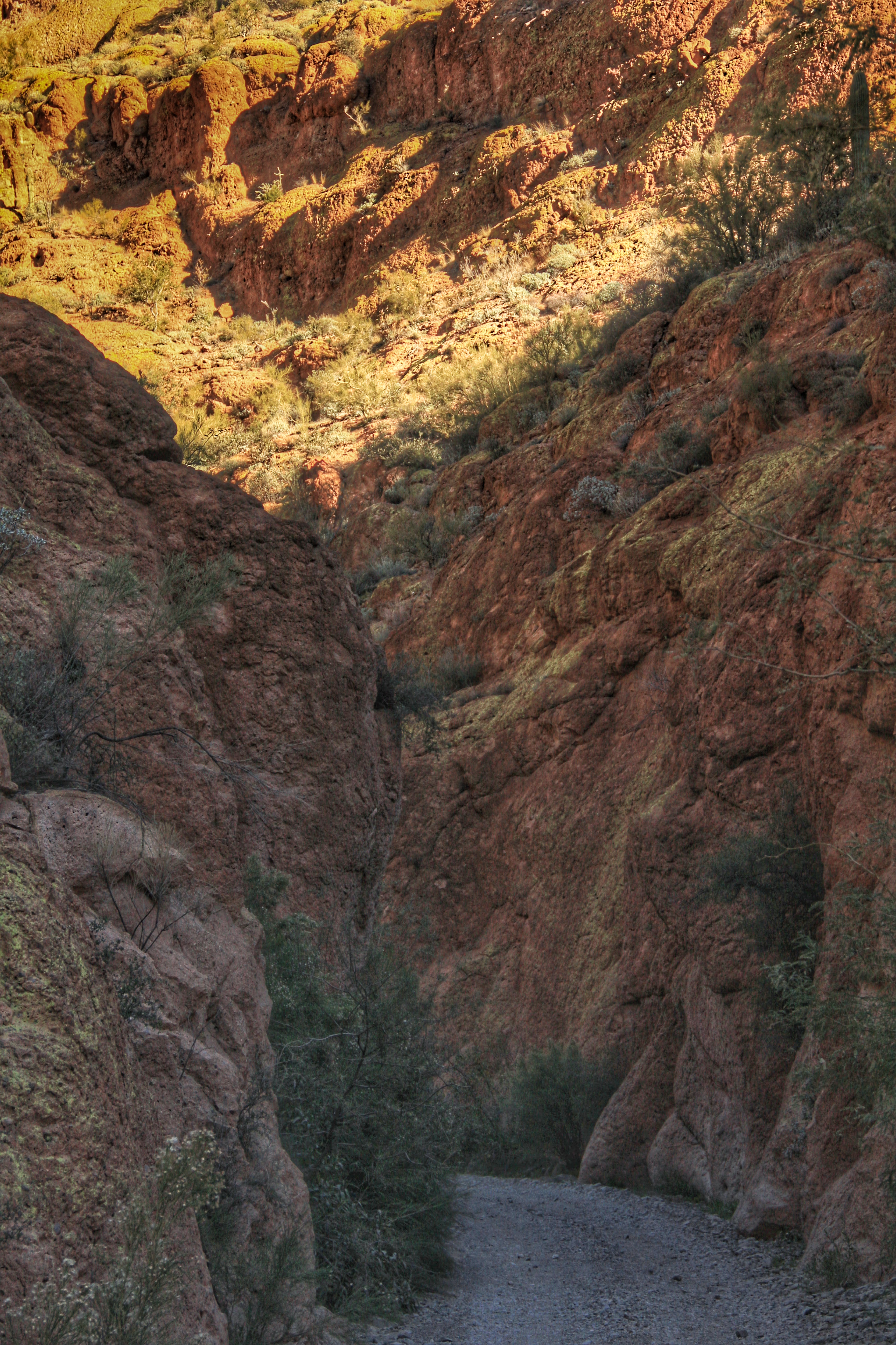
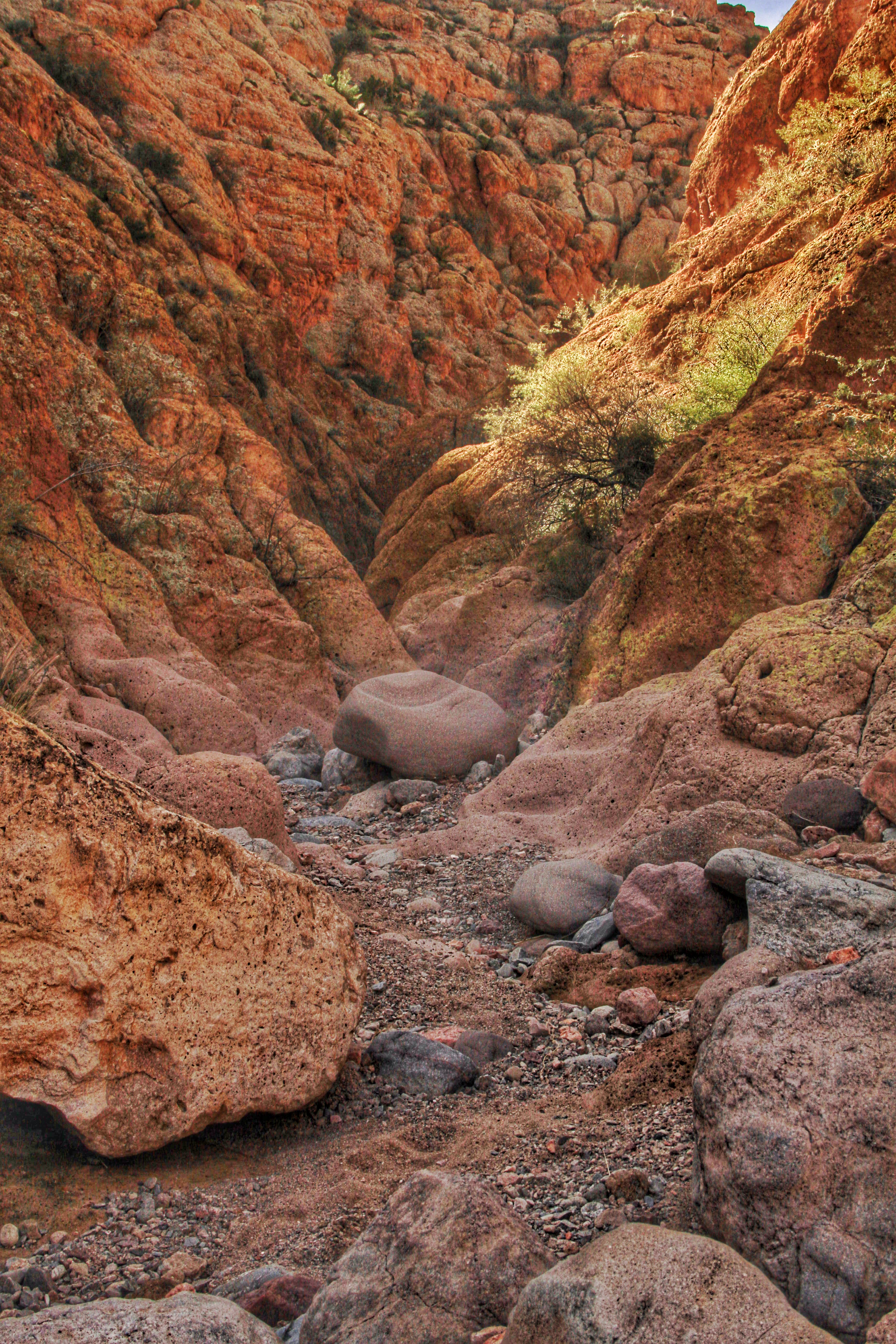
The main attraction of this hike is the next 2 miles or so, where the creek has carved a twisty narrow slot canyon through dark red and brown sandstone.


Here the creek bed often consumes the entire width of the canyon, and “dry feet” becomes something of a challenge!

Even deep in the canyon there are the ubiquitous ATV tracks!


After about 2.5 miles, the canyon opens up again, and the creeks meanders its’ way down to join the Salt River (AKA: Saguaro Lake).
The remainder of the hike consists of retracing our steps back upstream to the old ranch site.
I think this hike is a worthy route to be on the club list, not soon after any significant rain event, nor if rain is in the forecast. The narrow slot canyon would be deadly if significant rain fell on the flanks of Four Peaks. George and I saw just one ATV all day, but I suspect it would be much busier on a Friday, so recommend this as “Wednesday only”.
Thanks, George, for a great hike. Even with boulder hopping and damp socks, it was the easiest ten miles I’ve hiked in a long time.
Posted in Arizona hiking
Tagged Arizona hiking, Four Peaks, Mazatzal, Mazatzal wilderness
3 Comments
Praying Hands and Slot Loop
For a variety of reasons I missed several hikes, but got “back on the trail” again on Wednesday, bound on a hike that was partially new to me. I’ve done the “out and return” hike to the Praying Hands formation, but rather than turn back at the “Hands”, the Wednesday hike was a “lasso” loop into territory I hadn’t hiked before.
We parked on First Water road at the Crosscut trailhead, then hiked Jacobs Crosscut trial to Treasure Loop. After a short segment of that trail, the route goes “off trail” for the remainder of the hike. Actually there is a trail for the entire hike, but it is an informal affair not documented on maps.

My mapping app gave a total distance was just under 5 miles, with elevation gain (and loss) of about 1,100 feet. Most of the gain is in a short segment after you leave the marked trail, climbing to the saddle at the praying hands.
It was a brisk morning, nice for hiking, and with some leftover haze in the air early. This scene from the desert floor silhouettes our destination against the morning sun.
 Here’s a shot of the “Hands” from a few hundred yards away. Some of the hikers are seen at the base of the formation, giving you a scale to judge the size.

Leaving the lunch stop at the base of the Hands, the hike goes eastward gently downward into the terrain seen in the shot below.

Looking backwards, the Praying Hands more resemble their name from this aspect.

Cairns are the “road signs” of western hiking. Generally they are a small stack of available rocks, often pyramidal in shape. But now and then someone has time on their hands and does something out of the ordinary. This finely balanced structure was about 18 inches tall, and must have taken considerable patience to assemble!
 Circling back we passed around a couple of volcanic remnants, and through a slot in one of them.

Back on the desert floor this small memorial had been erected along the trail. RIP, Dwight, whoever you were.

On to the hikes of the new year 2016. “Lonesome” George is back on board, and that’s always a promise of something new.
Boulder Canyon Trail
“Why am I doing this hike again?”
That’s the question which crosses my mind every time as I start the drudge of climbing out of the Salt River basin at Canyon Lake trailhead on the Boulder Canyon Trail. This isn’t an easy hike, especially at the start. The first mile is a relentless climb on crappy footing with seemingly endless “false summits”. It’s easy to misplace your focus on the task of “putting one foot in front of the other”.
The trick to enjoy this hike is to “stop and look back” on this ascent. This furry fellow, in fact, seemed to be doing just that. Even with the advantage of 8 legs to my 2, he was taking a break to enjoy the view.

Tarantula on the trail
Taking a pause at this point to look back, you see the man-made Canyon Lake behind you. The dam which forms the lake is near top center in the photo below.
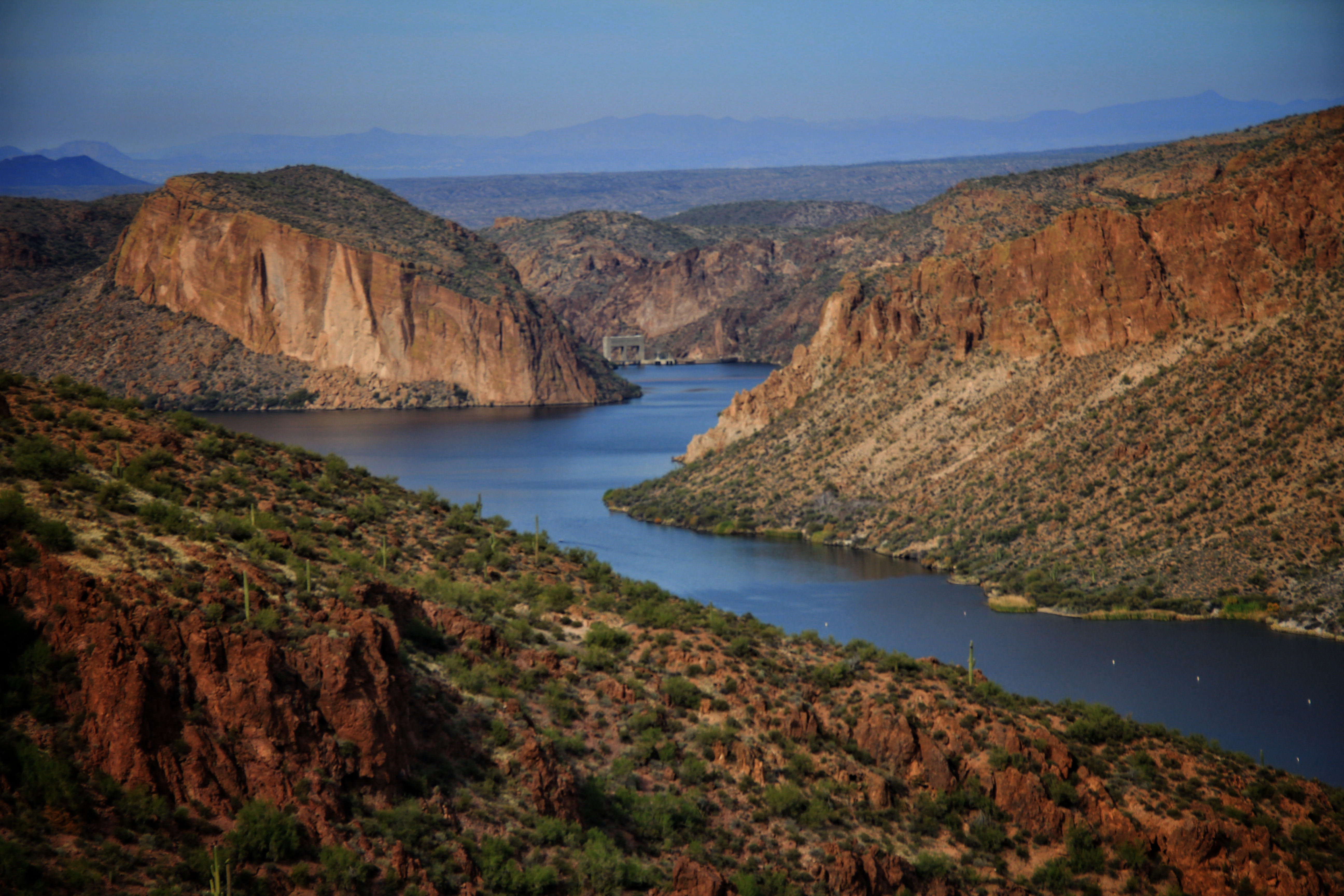
Canyon Lake
To the north and east are wide panoramas of the Goldfield and Four Peaks area.

Four Peaks in the distance

Cliffs in the Goldfields
This scene on the ascent looks southwest. Flatiron is in the top-left of the scene.

Looking SW towards Flatiron
Here is a view looking down into Boulder Canyon (which brings up the question “Why do they call the trail “Boulder Canyon Trail”, since we never hike in Boulder Canyon?”).

Boulder Canyon
Thankfully, the trail finally crests, and there is an easy gradual descent around a minor peak. This descent passes through a saddle (if you’ve been there, you know the spot) and suddenly the angular and harshly beautiful interior of the Superstitions opens to view.
At left-center of this scene is Battleship Mountain, with the iconic Weavers Needle in the distance at right-center.

Battleship Mountain
A grove of autumn-yellow cottonwood trees deep in Boulder Canyon is a visual exclamation point in the scene below.

Boulder Canyon
Finally, we reach the turnaround point in out hike. I never tire of this scene. The ragged and rugged interior of the Superstition wilderness seems to stretch on forever from here. Below is LaBarge Canyon, Battleship Mountain dominates the middle-ground, and Weavers Needle flanks her in the background.

LaBarge Canyon Overlook
That my friends, is why I take this hike every time it is on the agenda. The scene is breath-taking. The formation at left is Geronimos Head, at center is Battleship Mountain with Weavers Need peeking over her fantail, and at the horizon the peaks and hoodoos around Barks and Peralta canyons.
At this overlook point there is a 900-foot drop down into LaBarge Canyon. You could continue your hike from here (see trail segment at lower left). Following the riverbed in the center of the photo would eventually lead you to the slot canyon at LaBarge Narrows. Or you could bear right in the bottom of the canyon into Boulder Canyon, pick up Second Water Trail through Garden Valley to First Water, or you could ….. well, the possibilities are endless.
Our group retraced out path back to the Canyon Lake trailhead. Remember the pretty lake scene near the start of this posting, (repeated below)?
Canyon Lake
On the return to the trailhead I wondered, if instead of a quiet lake here, there was the original canyon of the Salt River. What would this scene be like? Instead of the dam, would there be a waterfall? Perhaps evidence of a streamside village built by a Salado tribe a thousand years ago?
What is lost so that the golf courses of Scottsdale are green and lush?
“Wilderness is not a luxury but a necessity of the human spirit, and as vital to our lives as water and good bread. A civilization which destroys what little remains of the wild, the spare, the original, is cutting itself off from its origins and betraying the principle of civilization itself.”
― Edward Abbey, Desert Solitaire
Posted in Arizona hiking
Tagged Arizona hiking, Battleship mountain, Boulder Canyon, Canyon Lake, Ed Abbey, tarantula, weavers needle
3 Comments
Color in the Canyons
This past week I hiked with the group in two canyon environments east of here in the area south of Superior, Arizona. Both hikes were selected because we expected to see good fall color in the canyon interiors.
(Because I’ve described the terrain of both hikes in previous posts here, I’ll skip the usual length/elevation data.)
Wednesday we hiked Arnett Canyon. This is an essentially flat trail along Arnett Creek in the north shadow of Picketpost mountain. The scenery did not disappoint us!
Here is Picketpost as seen at the head of the canyon.

And several scenes along the route. Add your own descriptions! The colors were excellent.


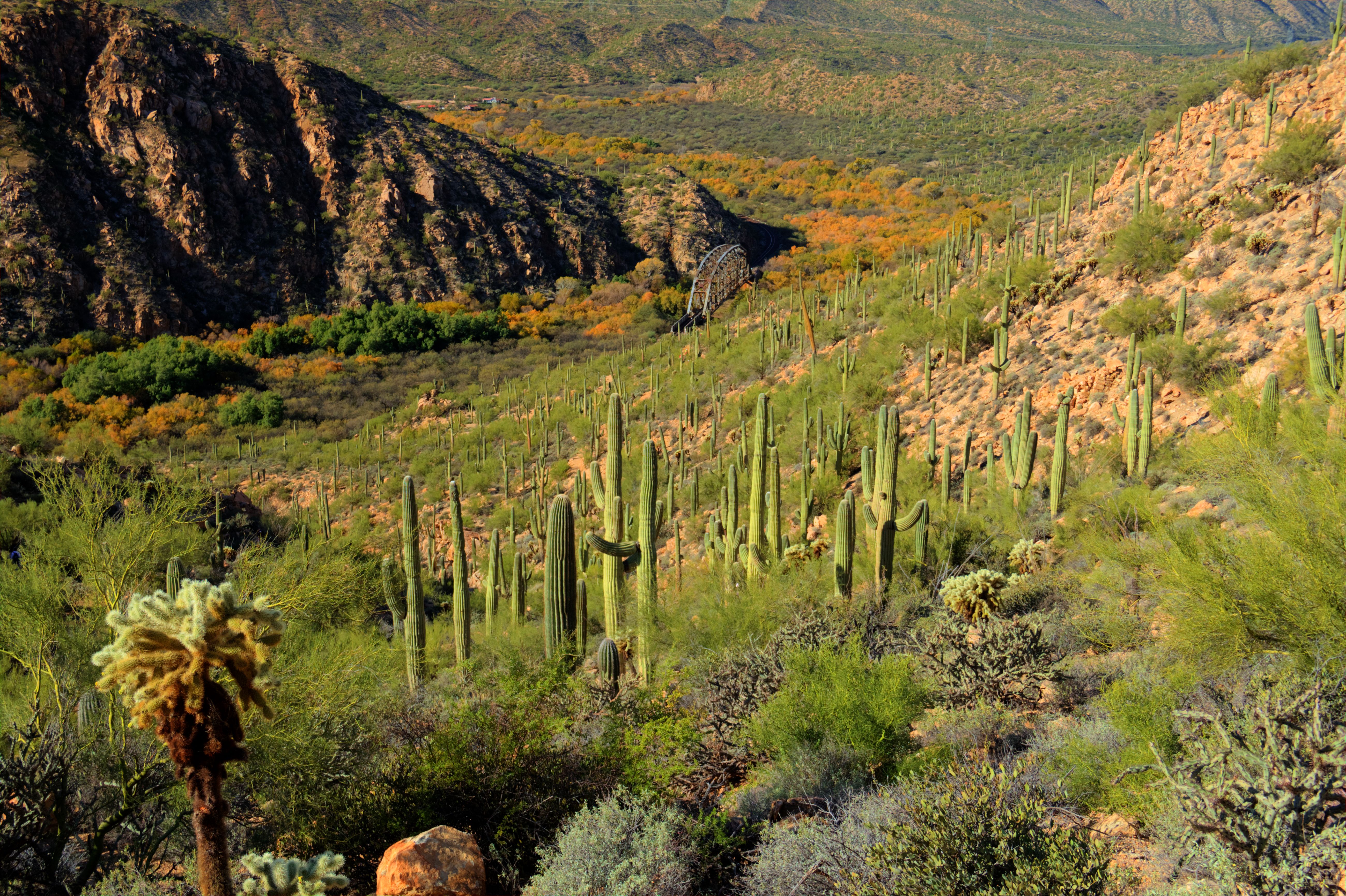
On Friday we hiked a segment of the Arizona Scenic Trail which follows the Gila River northward out of the little mining town of Kelvin, AZ.
This trail, rather than follow the canyon bottom like our Wednesday hike, ascends along the south side of the canyon in a rolling route which eventually descends back down to the river at an old railroad trestle.
The autumn color here was good too, but not as intense as at Arnett canyon. Here are a few scenes from that route.

I was surprised at the prevalence of flowers along this route. Don’t know what this blue one is, but there were three or four “mini-meadows” like this along the trail. Also saw some scattered globe mallow which is typically a March arrival.

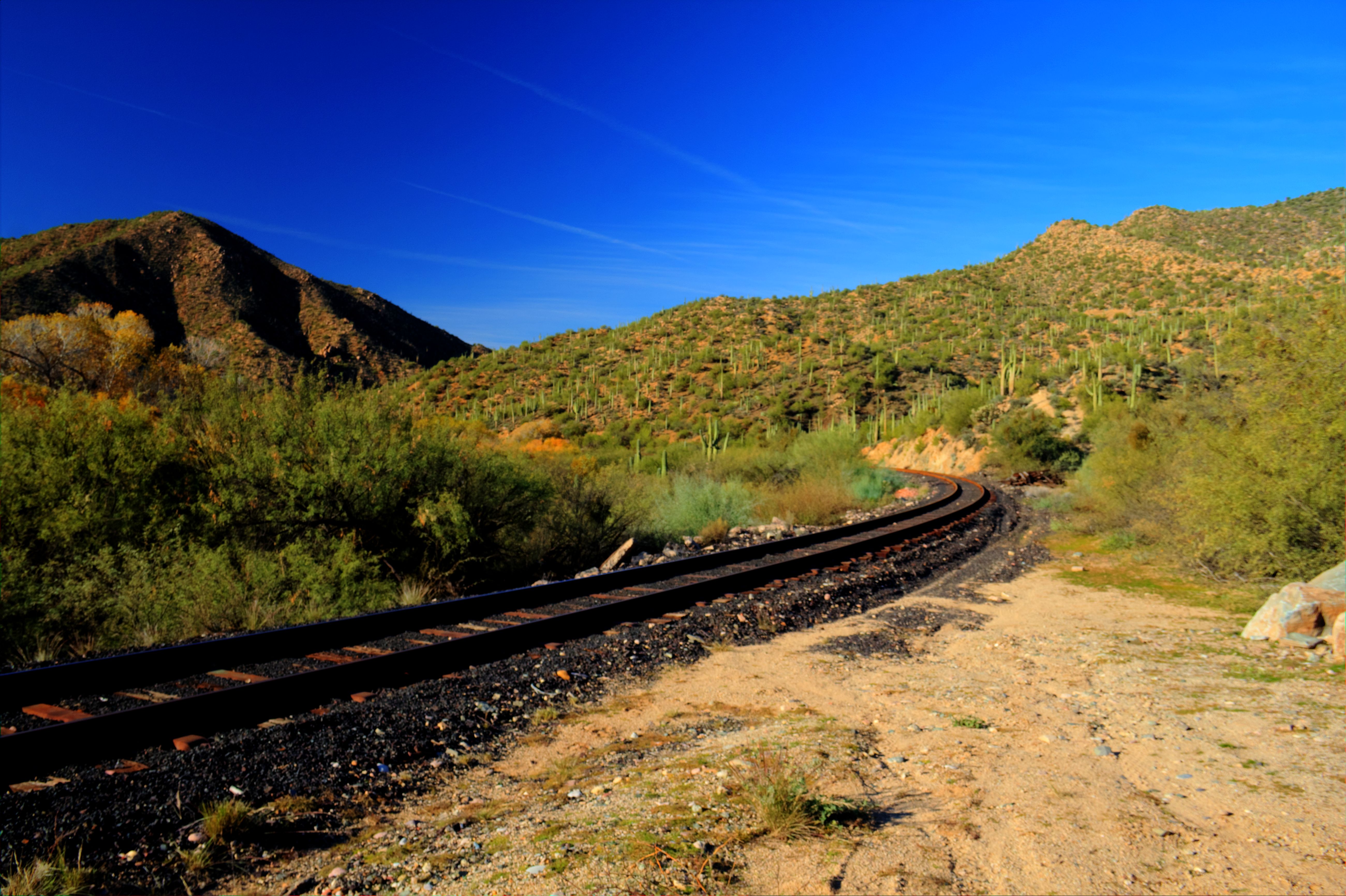
At the railroad trestle we at our lunch, and returned to the trailhead via the flatness of the railroad tracks.

For Edward Abbey Fans….
Some of his quotes which resonate with me. The first one, especially! I just found it this evening, and it embodies my theme of “Wandering about with no supervision” exactly!

“We can have wilderness without freedom; we can have wilderness without human life at all, but we cannot have freedom without wilderness, we cannot have freedom without leagues of open space beyond the cities, where boys and girls, men and women, can live at least part of their lives under no control but their own desires and abilities, free from any and all direct administration by their fellow men.”
― Edward Abbey

“The cactus of the high desert is a small grubby, obscure and humble vegetable associated with cattle dung and overgrazing, interesting only when you tangle with it the wrong way. Yet from this nest of thorns, this snare of hooks and fiery spines, is born once each year a splendid flower. It is unpluckable and except to an insect almost unapproachable, yet soft, lovely, sweet, desirable, exemplifying better than the rose among thorns the unity of opposites”
― Edward Abbey

“Beyond the wall of the unreal city … there is another world waiting for you. It is the old true world of the deserts, the mountains, the forests, the islands, the shores, the open plains. Go there. Be there. Walk gently and quietly deep within it. And then —
May your trails be dim, lonesome, stony, narrow, winding and only slightly uphill. May the wind bring rain for the slickrock potholes fourteen miles on the other side of yonder blue ridge. May God’s dog serenade your campfire, may the rattlesnake and the screech owl amuse your reverie, may the Great Sun dazzle your eyes by day and the Great Bear watch over you by night.”
― Edward Abbey

“when the cities are gone and all the ruckus has died away. when sunflowers push up through the concrete and asphalt of the forgotten interstate freeways. when the Kremlin & the Pentagon are turned into nursing homes for generals, presidents, & other such shit heads. when the glass-aluminum sky scraper tombs of Phoenix, AZ barely show above the sand dunes. why then, by God, maybe free men & wild women on horses can roam the sagebrush canyonlands in freedom…and dance all night to the music of fiddles! banjos! steel guitars! by the light of a reborn moon!”
― Edward Abbey
“My most memorable hikes can be classified as ‘Shortcuts that Backfired’.” — Edward Abbey
Posted in Arizona hiking
Leave a comment
A Blessing for Hikers

“Benedicto: May your trails be crooked, winding, lonesome, dangerous, leading to the most amazing view. May your mountains rise into and above the clouds. May your rivers flow without end, meandering through pastoral valleys tinkling with bells, past temples and castles and poets towers into a dark primeval forest where tigers belch and monkeys howl, through miasmal and mysterious swamps and down into a desert of red rock, blue mesas, domes and pinnacles and grottos of endless stone, and down again into a deep vast ancient unknown chasm where bars of sunlight blaze on profiled cliffs, where deer walk across the white sand beaches, where storms come and go as lightning clangs upon the high crags, where something strange and more beautiful and more full of wonder than your deepest dreams waits for you — beyond that next turning of the canyon walls.”
― Edward Abbey
Posted in Arizona hiking
Leave a comment
